I. Background and Rationale
- The first-class Coastal Protection Plans executed by the River Basin Branches were announced by the Ministry of the Interior (MOI) in 2020.
- The higher-level plan—“Overall Coastal Management Plan: First Comprehensive Review”—was formally submitted to the Executive Yuan in May 2023.
- In light of new comments raised during plan reviews and the inclusion of outlying islands in management scope, the WRA’s “Reference Manual for Integrated Coastal Protection Planning and for Formulating Coastal Protection Plans” requires rolling updates to guide subsequent comprehensive reviews.
II. Key Tasks
1. Revise the delineation method for storm-surge overtopping/inundation potential extent
- Issue identified: Using a no-seawall scenario produced overly large inundation overlays, complicating management and blurring focus on critical risk areas.
- Revised approach: Use a with-seawall scenario, incorporating climate-change increments (e.g., storm-surge run-up and wave-overtopping volume) in the overlay.
- Pilots: Chiayi and Tainan coastal areas (Fig. 1).
- Example: Tainan Zengwen reclaimed land—the landward buffer zone contracts toward the sea by ~82%, enabling a sharper focus on landward buffers and clearer definition of the second coastal defense line.
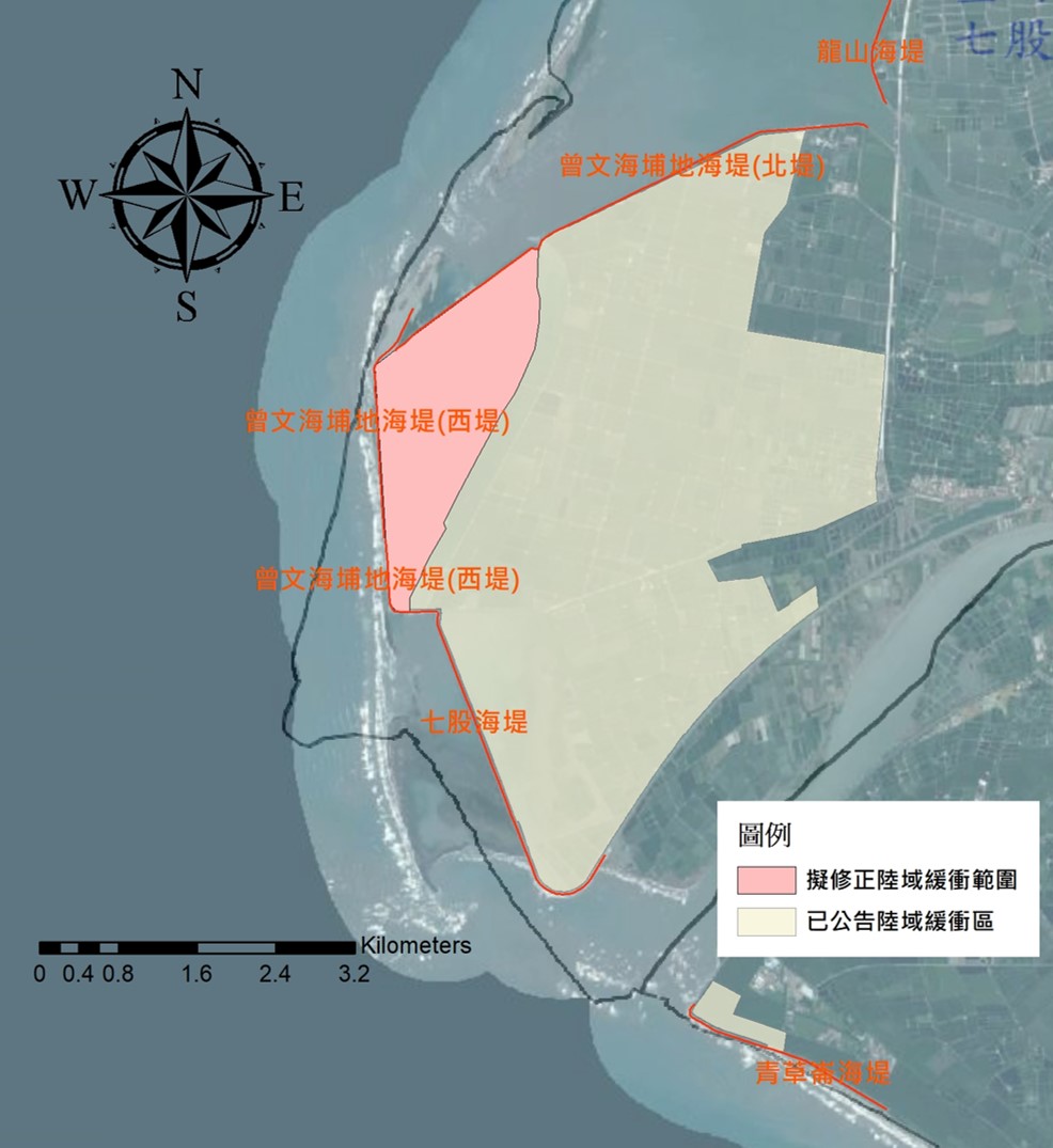
Fig. 1 Expected substantial reduction in the designated buffer zone after revising the manual’s delineation method for storm-surge overtopping/inundation potential.
2. Include outlying-island locations and delineation principles
- Based on the Branch’s 2021 (Minguo 110) study “Exploration of Delineating Coastal Protection Zones for Outlying Islands,” actions include:
- Incorporating outlying islands to complete national spatial coherence.
- Revising littoral (sediment-transport) cell boundaries.
- Adding a workflow to define shoreline segments where bathymetric/topographic data are sparse (Fig. 2).
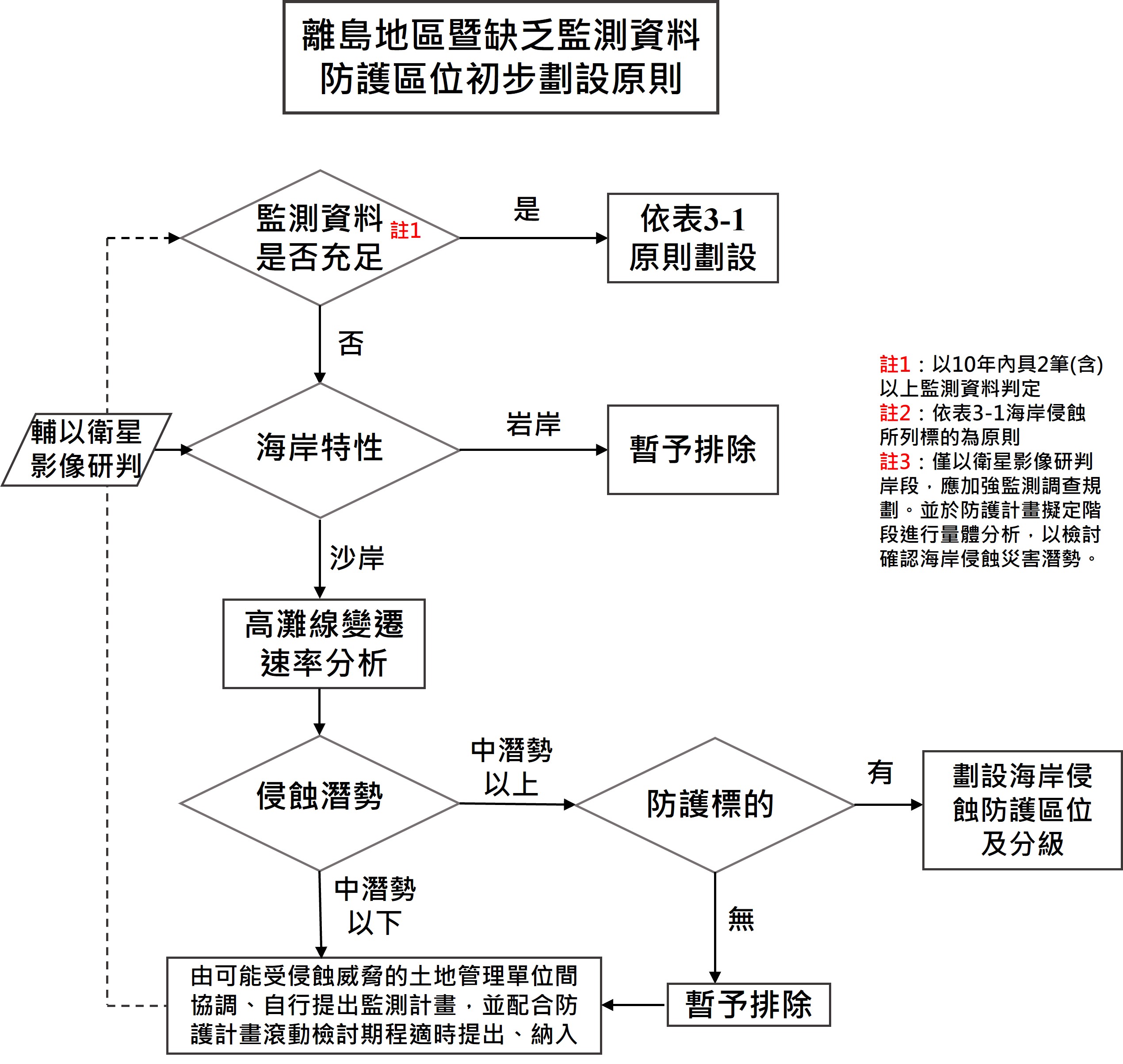
Fig. 2 Preliminary delineation principles for protection zoning in outlying-island areas and segments lacking monitoring data.
3. Amend the Manual’s general principles per review resolutions
- In line with coastal review decisions:
- Include port onshore areas in protection-zone reviews.
- Extend the erosional shoreline projection horizon to the 20-year position.
- Harmonize legal terminology.
III. Completed Work and Deliverables
1. Consensus on narrowing the storm-surge inundation potential extent
- After multiple consultations with WRA, River Basin Branches, and experts, a consensus was reached on the need to reduce the delineated extent.
- Operability was validated through trials and reflected in Manual revisions; subsequent delineation will be carried out by River Bureaus and local governments, with regular rolling reviews.
2. Rolling review of coastal protection zoning
- Main island: Provisionally maintain the first- and second-class protection zones per the 2017 (Minguo 106) Overall Coastal Management Plan (Fig. 3).
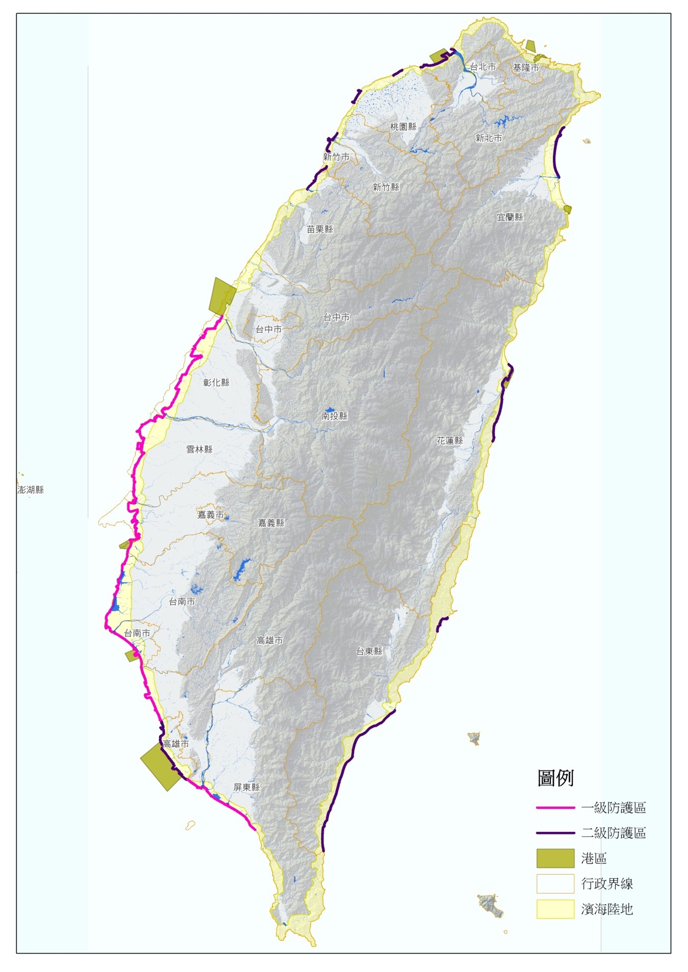
Fig. 3 Distribution of Class I and Class II coastal protection zones.
- Outlying islands: Add the review scope; no specific zones are delineated at this stage.
3. Submission of Manual revisions
- Reflecting the higher-level plan and implementation experience, the Manual was updated on a rolling basis and the August 2023 revision was formally transmitted to the WRA on August 11, 2023; formal promulgation will follow upon WRA approval.