Promoting Nature-based Solutions (NbS) Strategies
Nature-based Solutions (NbS) were first proposed and defined by the International Union for Conservation of Nature (IUCN) as:
“Actions to protect, sustainably manage, and restore natural or modified ecosystems that effectively and adaptively address societal challenges, while simultaneously providing human well-being and biodiversity benefits.”
The overarching goal of NbS is to address major societal challenges such as food security, climate change, water security, human health, disaster risk reduction, and social and economic development.
In line with this concept, the Water Resources Planning Branch has adopted NbS as the foundation for integrated watershed management and governance strategies in the Toushe Basin, Yuchi Township, Nantou County. The project aims to establish feasible and sustainable approaches that combine both structural and non-structural flood management measures to maximize effectiveness and minimize flood risks. Ultimately, these efforts not only strengthen sustainable water security but also enhance resilience and improve community well-being.

Figure 1. Community engagement in Toushe Basin
Baseline Survey and Pilot Testing for Peatland Water Retention and Soil Conservation
Although peatlands cover only 3% of the Earth’s land surface, they store 44% of global soil carbon—more than the combined carbon stored in all other vegetation types worldwide. Conserving peatlands is therefore a critical measure to mitigate climate change at its source.
This project focuses on Taiwan’s largest peatland—the Toushe Basin—aiming to preserve its ecosystem services while establishing a demonstration site for sustainable NbS governance. Through continuous stakeholder platforms, baseline surveys, and cross-sectoral cooperation, the project promotes local participation and explores the societal challenges faced in the region. It conducts comprehensive analyses of hydrological, hydraulic, land use, and ecosystem conditions, with NbS serving as the guiding principle to develop effective peatland conservation and sustainable management strategies.
The project includes interdisciplinary workshops, knowledge-sharing events, baseline soil and hydrological surveys, and in-depth analyses. It further explores “water retention and soil conservation strategies” through pilot field tests and monitoring, assessing their potential benefits to ecosystem services and human well-being. The outcomes will provide valuable insights into the feasibility of applying NbS and peatland management strategies in Taiwan’s unique ecological context.
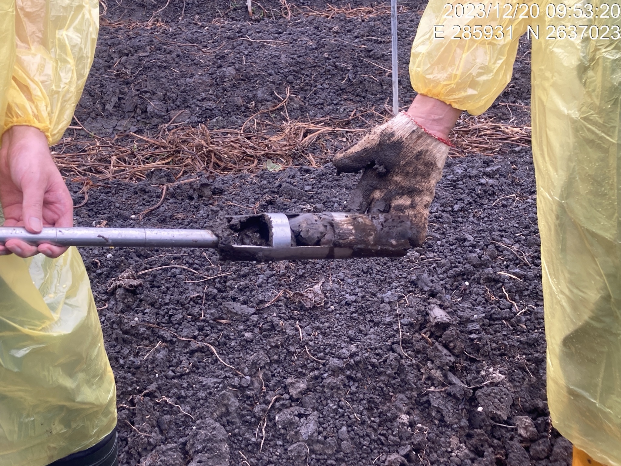
Figure 2. Soil sampling survey in the peatland
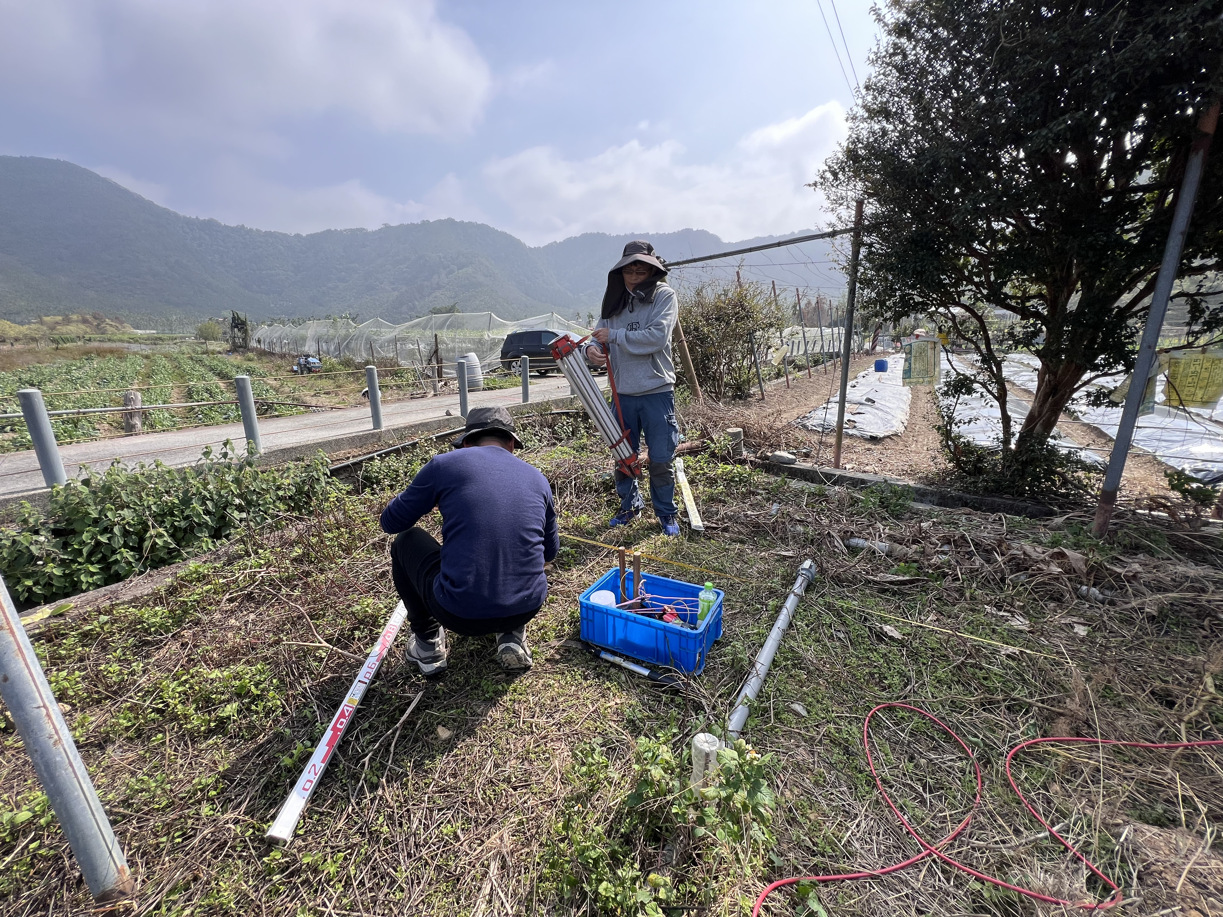
Figure 3. Geoelectrical survey in Toushe Basin
InSAR Monitoring
The Water Resources Planning Branch applies Interferometric Synthetic Aperture Radar (InSAR) technology to assess long-term land subsidence and flood-prone conditions in the Toushe Basin. With its advantages of comprehensive, real-time, and periodic data collection, InSAR provides a scientific foundation for evaluating and planning future improvement measures.